Yesterday morning we left Telluride and drove a long day out of the mountains to Trinidad, Colorado. We were going to stop over in Durango for a couple of days to camp, but it was supposed to rain, we are out of clean clothes, and we are pretty much ready to go home. We will arrive home in Georgia on Monday afternoon. In June and July we were gone 25 days, and this time will have been gone 12 days, so our 2024 Western Adventure has been 37 days total, enough for this year.
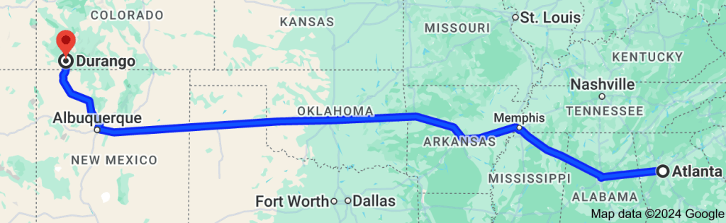
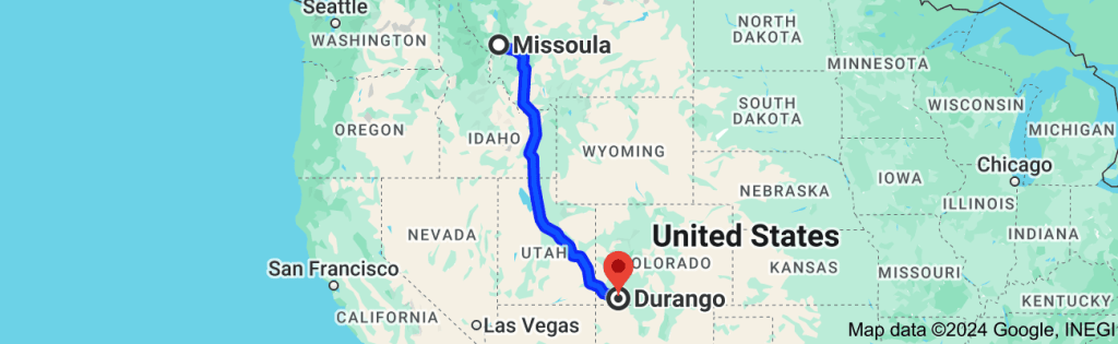
When we reached Durango, Colorado yesterday afternoon, it was “Deja vu all over again” (Yogi Berra, 1961). We are now backtracking across America. The route below is not quite what we did, because after we reached Durango in June, we went through Wyoming to visit the Tetons and Yellowstone. But, to give you a visual:
Georgia to Durango in June Durango to Glacier in JuneGlacier Back to Missoula in JuneMissoula to Durango in SeptemberDurango to Georgia in September
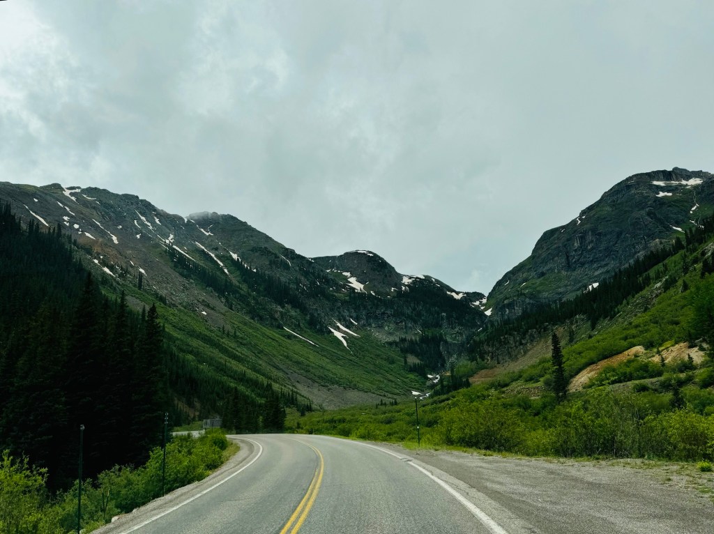
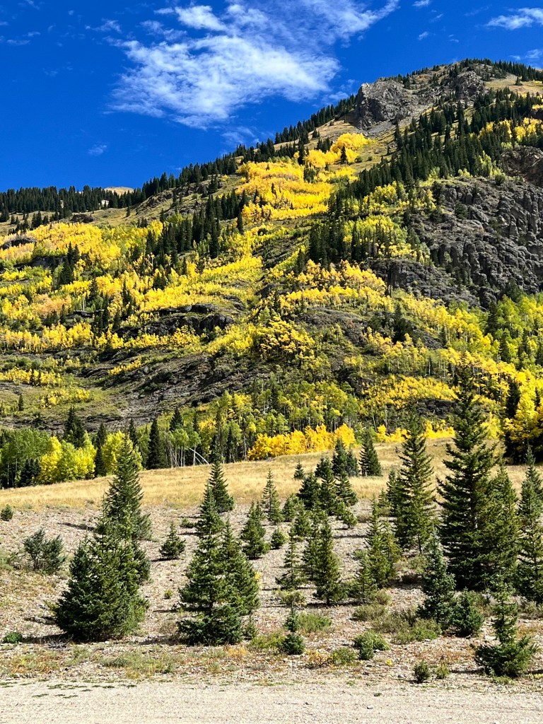
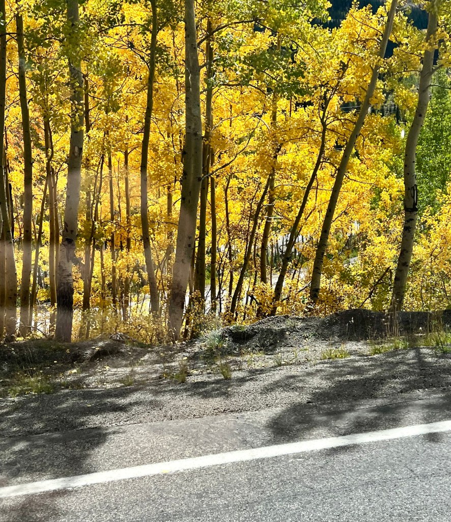
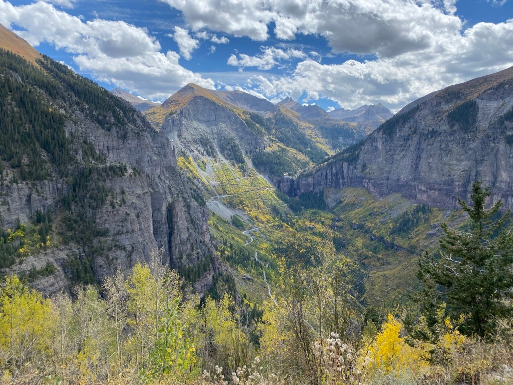
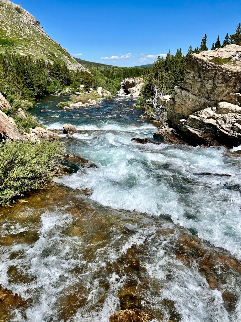
We Below are pictures from the Million Dollar Highway from Ouray to Silverton in June, 2024, and then from yesterday. Not quite in the same place, of course, but what a difference in colors.
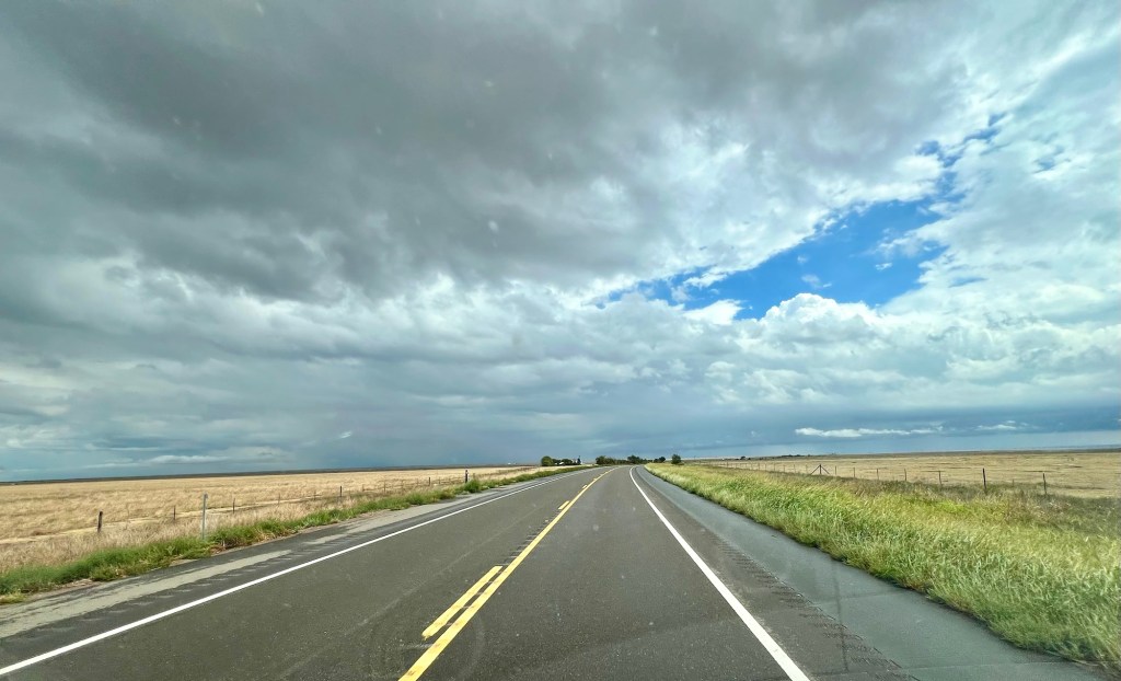
Most of our drive has been scenic and interesting, but it’s so boring to get out of the mountains and back on the interstate to travel across Texas, Oklahoma, Mississippi, and Alabama. In John Steinbeck’s iconic travel book, “Travels With Charley,” he sets out from Long Island, New York with his dog, Charley, to make a cross-country trip to California. This is what he said about interstate highways: “The interstate highway system is a wonderful thing. It makes it possible to go from coast to coast without seeing anything or meeting anybody. If the United States interests you, stay off the interstates.” I agree. The interstate this year in June and then in September:
I know I have mentioned travel books several times in this blog, but if you would like to read some good books about traveling across America, try Bill Bryson’s “The Lost Continent,” Charles Kuralt’s “On the Road,” William Least Heat Moon’s “Blue Highways,” and the aforementioned John Steinbeck’s “Travels With Charley.” (I was on a major reading binge with travel books a few years ago.)
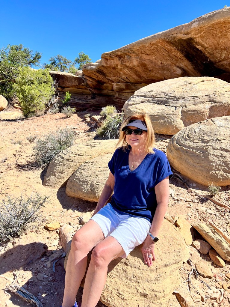
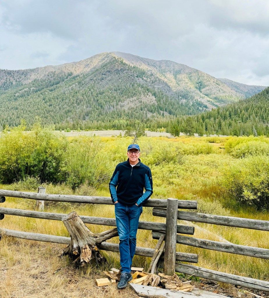
This morning we drove from Moab, Utah to Telluride, Colorado, where we are spending the night at the New Sheridan Hotel. The New Sheridan was built in 1885 and is on West Colorado Avenue, the main street that runs through the center of town. As usual, parking Vanna in a small mountain town for an overnight stay was a true joy. Luckily, Telluride has an overnight permitting system, unlike Whitefish and Jackson, Wyoming, where there are signs every six feet that say, “No Overnight Parking, You Big Fat Losers!” In case you are wondering, we stay in Vanna about half the time and in a hotel the other half. We like to stay in the center of towns where we can walk to shops and restaurants. Camping is fun, but one can enjoy only so much nature on one’s trip.
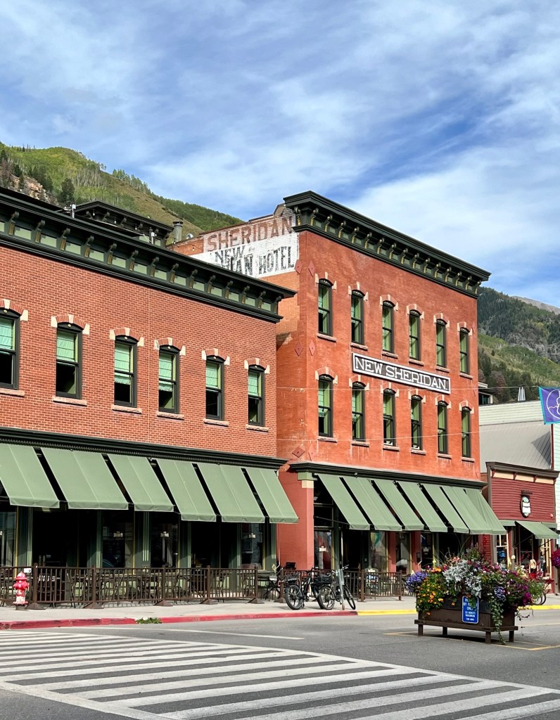
Downtown Telluride
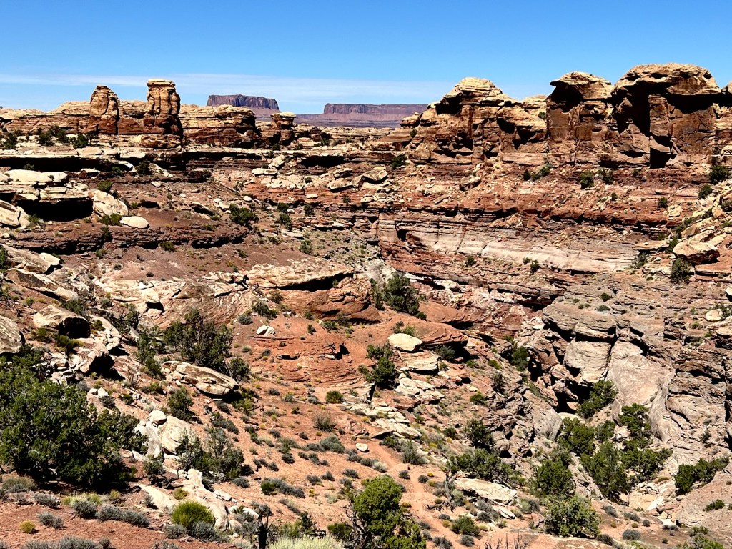
Yesterday on our last day in Moab we drove to the Needles area entrance of the Canyonlands National Park. Canyonlands includes a colorful landscape of canyons, mesas and buttes by the Colorado and Green Rivers. There are two paved entrances to the park—Island in the Sky (where we were two days ago on the Shafer four wheel drive trail) and Needles. What we saw the day before on the Shafer Trail was so spectacular that Needles seemed kind of ho-hum. All in your perspective, I suppose. Also, the entire area around Moab is stunning, so the park is just more of the same landscape.
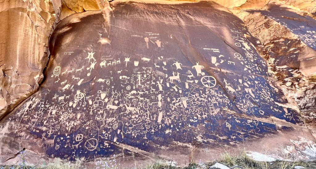
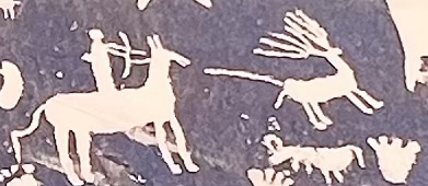
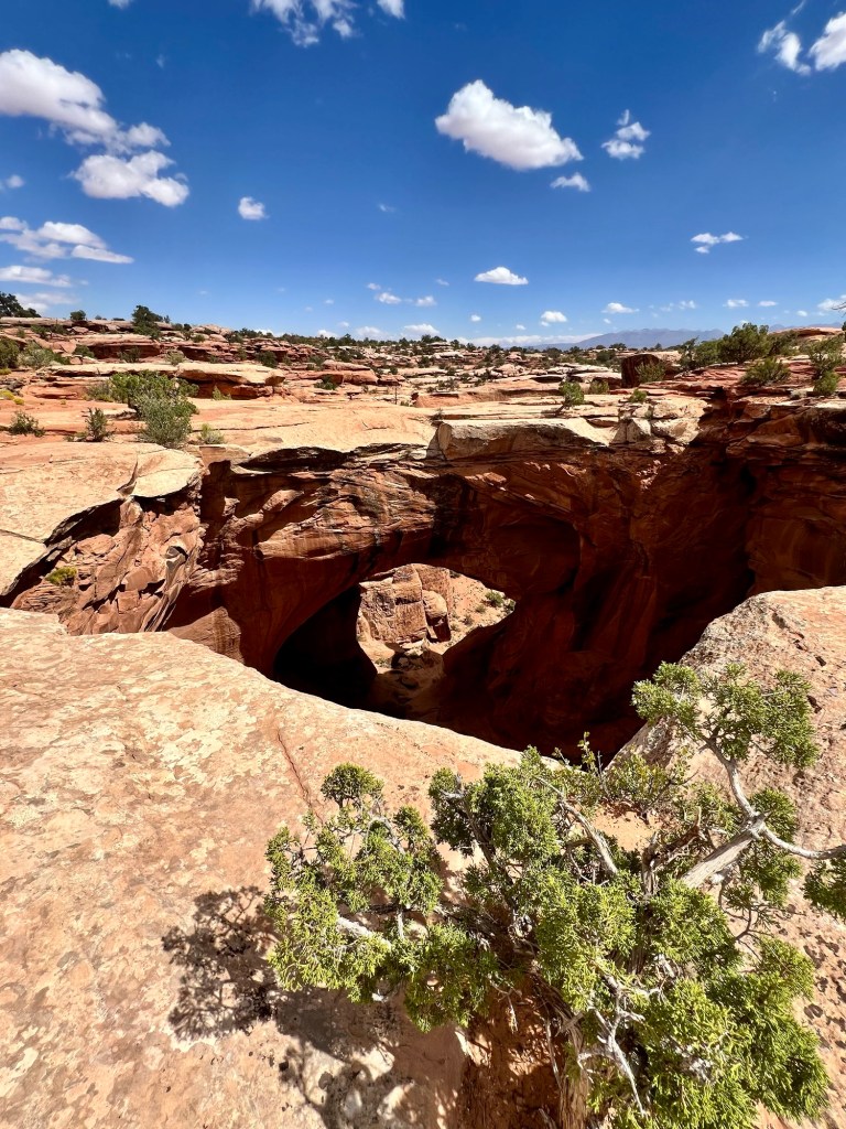
We did stop on the way to the park at Newspaper Rock State Historic Monument, which is a rock panel carved with one of the largest known collections of petroglyphs. The 200-square-foot rock site is a part of the cliffs all along the upper end of Indian Creek Canyon, and features examples of drawings from a variety of cultures, including the Fremont, Anasazi, Navajo, and other ancestral Puebloan peoples.Petroglyphs are rock carvings (rock paintings are called pictographs) made by pecking directly on the rock surface using a stone chisel and a hammerstone. Some petroglyphs seem to depict real events, while others appear to be abstract. Notice in the enlarged picture that the hunter on the horse used a bow and arrow to shoot the deer right in the buttocks.
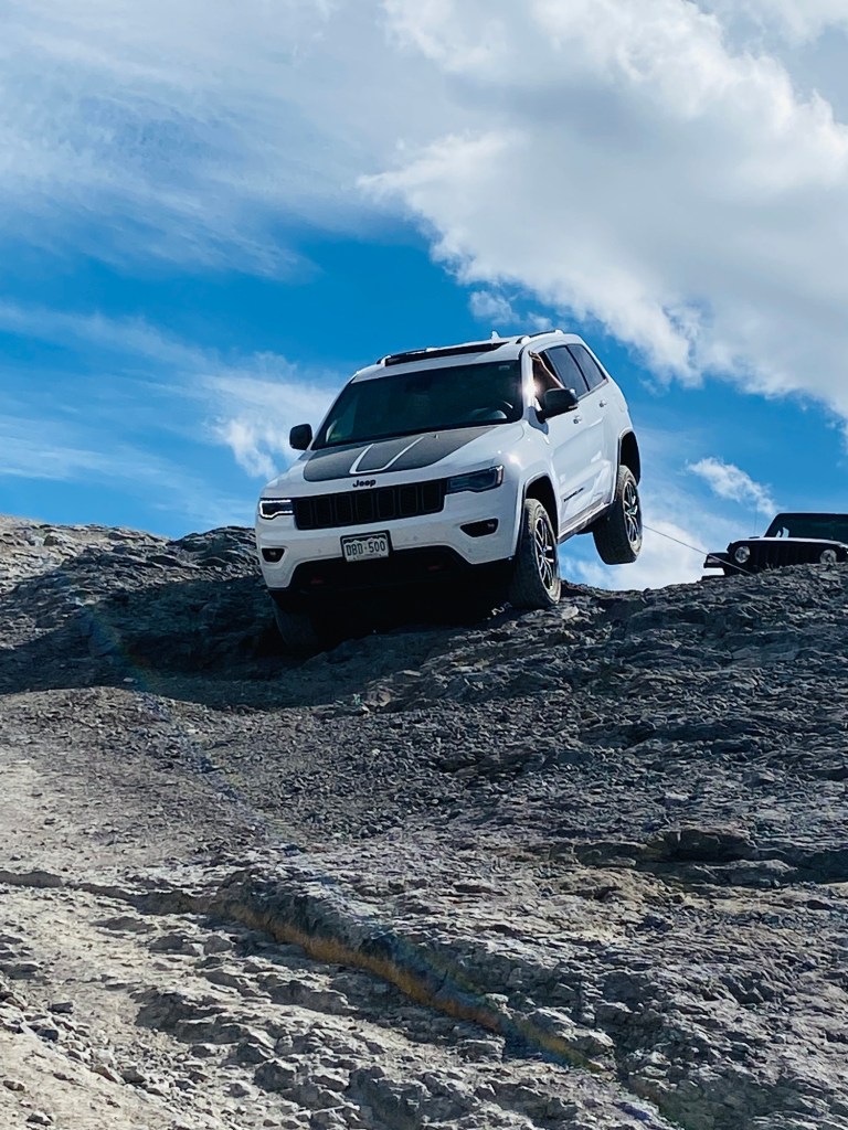
And finally, in 2021 we were in Telluride after driving in a jeep over Imogene Pass, a much scarier situation than our four wheel drive trip a couple of days ago. Imogene Pass is one way to get here, but definitely not what I would suggest. The jeep in the last picture was high-centered on a big rock and had to be towed out backwards. Scariest thing I have ever seen.
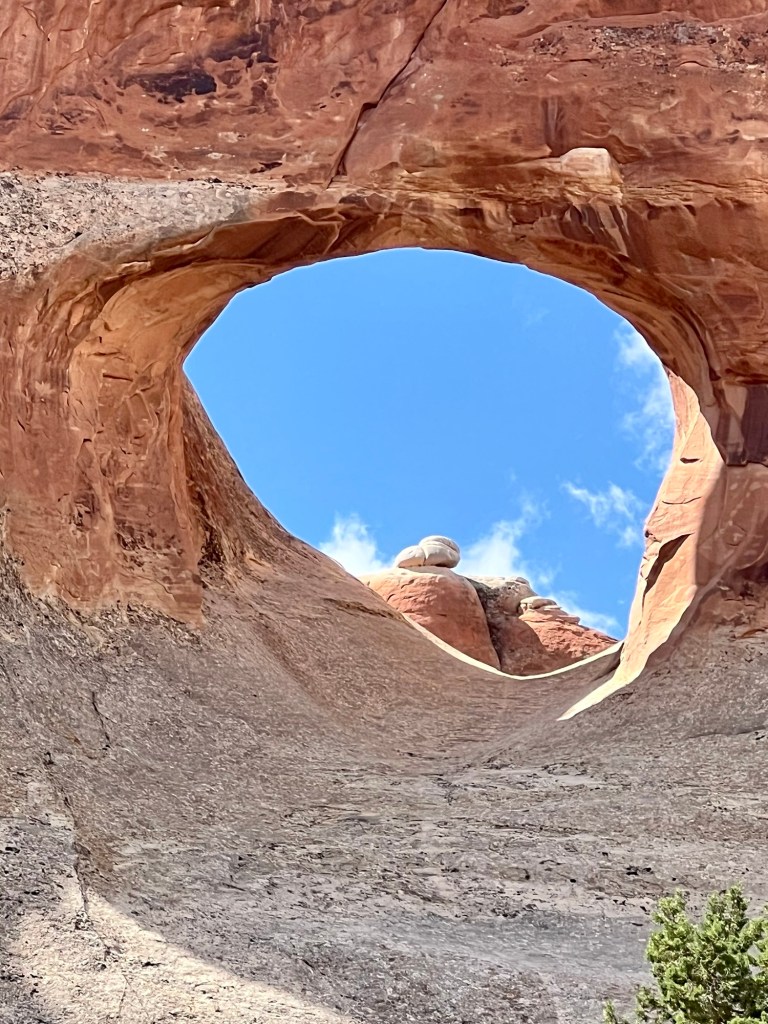
Today we went on a couple of four wheel drive trails up in the mountains, down in the canyons, across the switchbacks, over the river and through the valleys. The jeep rental company gave us a booklet and it suggested for “easy” trails, we should go up on the Gemini Bridges Trail (13 miles), then into Canyonlands National Park, and then take the Shafer Trail (18 miles) back down. The booklet said that the Gemini Bridges Trail was “moderate” and the Shafer Trail was “easy.” Perhaps moderate and easy for some, but teeth-jarring and neck and back stiffening for anyone over 50. Maybe we are just too old for this crap? I thought the day would never end. Anyway, we ran the gauntlet, so pictures there must be.
First, pictures of the two Gemini Bridges, which are huge sandstone arches. Pretty cool.
By the way, have you seen the UTV’s (utility task vehicles) they drive off road on the trails now? I’m guessing not. They seat people side by side and look a bit like a spider when they are moving. I do not claim to understand the suspension system, but they kind of crawl over rocks and hills with their tires in different positions. We saw a ton of them today.
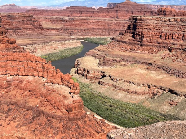
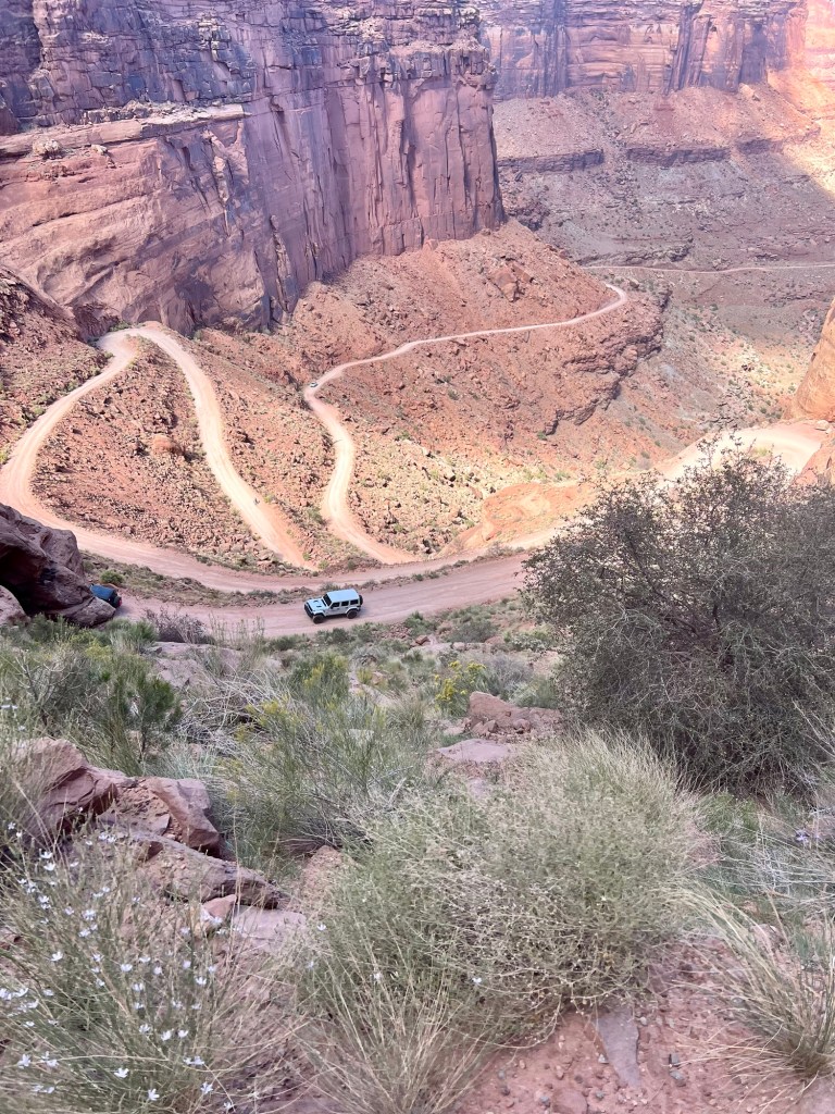
After that, we were on the Shafer Trail. It was a bit scary in places. The body of water is the Colorado River.
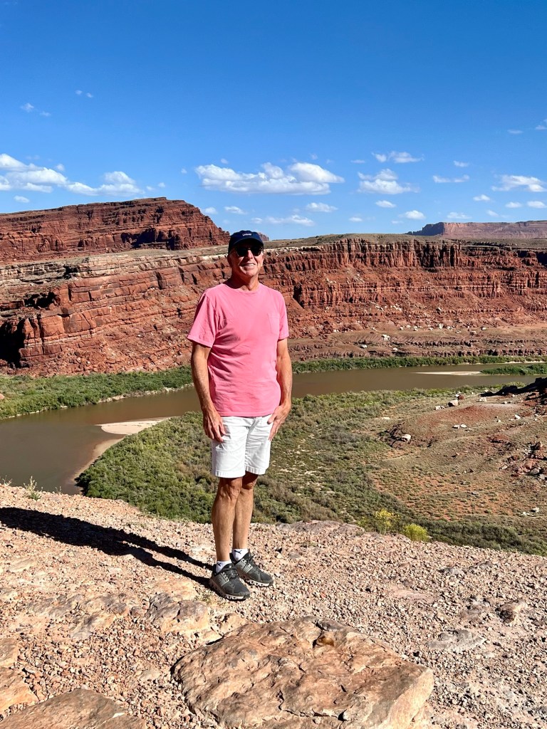
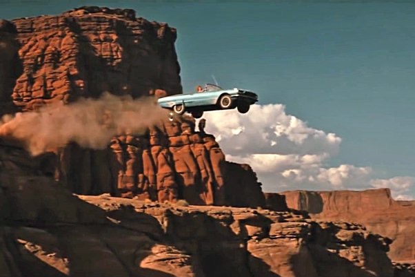
Remember when Thelma and Louise drove their 1966 Ford Thunderbird convertible off the cliff? Well, that was at Dead Horse Pointe, right where we were today. Although the final scene was supposed to be at the Grand Canyon, it was filmed right here in Utah. The first picture is approximately where they filmed the “going off the cliff scene.” The second picture is a stock picture of them going off the cliff, which looks pretty fake.
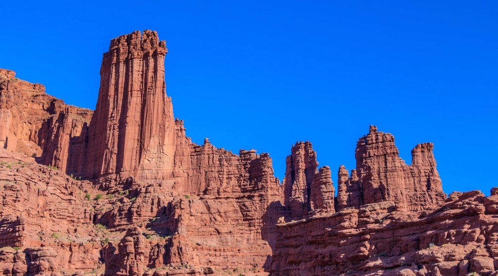
Oh, and Doug had another dessert for breakfast at the Moab Diner before we set out this morning called Fisher Towers French Toast, named after Fishers Towers near Moab. Don’t worry, he didn’t eat the butter.
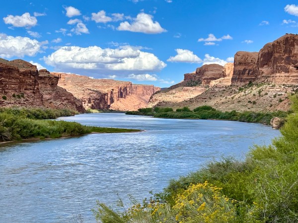
Yesterday we drove from Mt. Pleasant, Utah to Moab, Utah, a distance of about 185 miles. Moab is lovely little historic town located about 5 miles from Arches National Park and about 30 miles from Canyonland National Park. The Colorado River runs through the Moab Valley right by Moab the town.
Colorado River at Moab
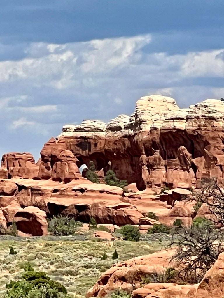
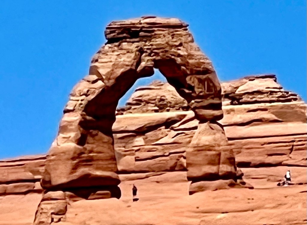
Today we visited Arches National Park, which is 73,234 acres of eroded sandstone fins, towers, ribs, gargoyles, hoodoos, balanced rocks, and arches. Delicate Arch is the most well-known of these arches with its 65-foot arc, but there are over 2,000 arches cataloged in Arches National Park. The park includes the largest proliferation of arches in the world, including Double O Arch, Broken Arch, Landscape Arch, Windows Loop, and Tower Arch. The Delicate Arch might be the one everyone has seen most often, as it’s the iconic image for Utah. Guess which of the following pictures is of Delicate Arch?
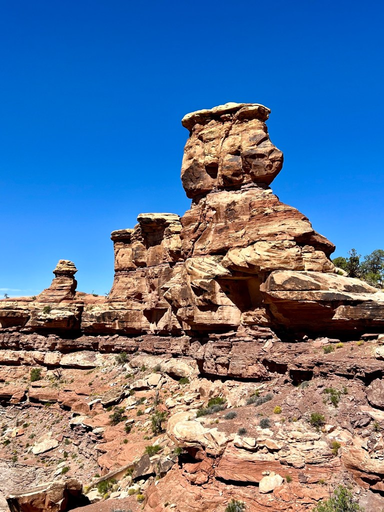
When I read that Arches has formations called hoodoos, I was confused. I only know about the hoodoo that is a set of spiritual practices that were created by African American slaves in the south. Remember the book and movie “Midnight in the Garden of Good and Evil?” The title alludes to the hoodoo notion of “midnight,” the period between the time for good magic (11:30pm to midnight) and the time for evil magic (midnight to 12:30am). What I didn’t know was that a hoodoo is also a column or pinnacle of weathered rock. Apparently, there is a connection between hoodoo spirituality and a hoodoo rock formation. A hoodoo rock resembles a strange human form, often topped by an overhanging ‘hat’ of harder rock. For example, in Bryce Canyon National park, Native Americans considered hoodoos petrified remains of ancient beings who had been sanctioned for misbehavior. The best example of hoodoos is the first photo. Don’t they do look like people? The second photo reminds me of a dinosaur—or I suppose a hoodoo dinosaur.
Today when we were driving around the park, Doug kept pointing out scenic or interesting things to me. It’s nice that he does this, but after several hours of it, I grow weary of acting interested. It reminded me of the time that Mom and Dad and their good friends Jay and Marilyn came to see us when we lived in Estes Park, Colorado for a short time in the 90’s. Estes Park is right at the entrance of Rocky Mountain National Park, so we decided to drive through the park one day while they were there. Doug drove and Daddy rode shotgun, while the rest of us sat in the back of the van. Of course, Daddy had a primo seat and could see everything, so he started yelling, “scenery alert!” every time he saw anything pretty. Since Doug was driving and the rest of us were sitting in the back with less of a panoramic view, there were several times when we couldn’t even see what Dad was pointing out. After a long day of this, Mom had finally reached her limit and said, “Les, give it a rest on the scenery alerts.” So when Doug points out the umpteenth thing of the day, all I have to do is say, “scenery alert!” and he gets the message.
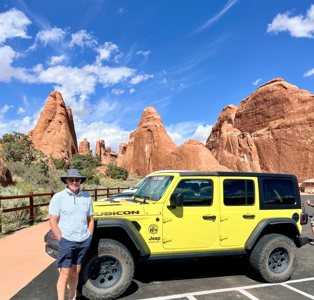
Doug by the Yellow Jeep we Rented Because we are Sick of Vanna
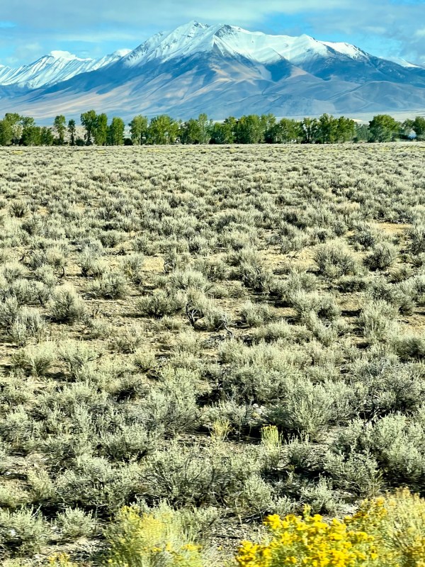
Today we drove about 260 miles south from Pocatello, Idaho to Mt. Pleasant, Utah. Mt. Pleasant is a small town about 100 miles south of Salt Lake City, and is just a stop over on the way to Moab, Utah, where we plan on spending spending the next few days seeing Arches National Park. In case you are wondering, we aren’t just randomly driving around out here, although it does seem that way some days. We are actually driving southeast towards home, but there’s a lot of meandering involved along the way. Here’s a picture of Vanna hanging with the big girls at a rest stop in Utah today:
This morning we ate breakfast at a local place called Abracadabras. They had incorporated a magic theme into the decor—think black top hat light fixtures and silver cutout stars hanging from the ceiling. Doug ordered the Cap’n Crunch Encrusted French Toast. Seriously. I said, “What are you, twelve years old?” The serving staff were all non-traditional hippie types. Our server had on a tee shirt that said, “I Hate People,” and another server had on a shirt that said, “Bite Me.” They all seemed nice, so I guess the shirts were an attempt at keeping it light. When we left, our server told us to have “the best day of your lives.”
Cap’n Crunch Encrusted French Toast
As we drove through Salt Lake City today, Doug kept asking me random questions that could only be answered by Mr. Google. “How much saltier is the Great Salt Lake than the ocean?” Well, according to the Utah State Parks site, the Great Salt Lake is 2 to 9 times more salty than the ocean. “Why is it salty?” A short search on Google got me this: The lake’s three major tributaries, the Jordan, Weber, and Bear Rivers together deposit about 1.1 million tons of minerals in the lake per year and it has no terminal outlet except for evaporation. So, these minerals accumulate and give the water a high salt content. I guess this is marginally more interesting than playing the “spot all of the license plates from different states” game. Of course, I didn’t take this picture of the Great Salt Lake, but I thought it was pretty:
On a side note, in my blog from June and July when we were out west the first time, I mentioned a raft trip down the Snake River in the Tetons that we took with our little girls circa 1980. When I arrived home, I found the picture. What a sweet memory.
Ann, Julie, Sara, Carrie
And, one more picture from Idaho yesterday morning.
For the last couple of days we have been driving south through Idaho towards Utah. We haven’t had a signal for a major part of the trip, so we have been using Vanna’s GPS. Yesterday, on our way to a campground near Ketchum, the GPS took us on a “shortcut” which included an unpaved road. Initially, we were lulled into a false sense of security, because the first 20 miles or so were paved. When we hit the unpaved section, we should have turned back immediately, but wishful thinking told us that our GPS wouldn’t take us on a wild goose chase (and remember, one of us has a strict no backtracking policy). After a long time on the gravel road, we came to a sign that said, “Stop! Narrow steep road! No trailers past this point, you stupid morons!” Or something very similar.
So, we had to turn around and backtrack on the same washboard road several miles. We were still on said horrible road when we noticed a campground along the way called Phi Kappa. (I know, it’s a weird name for a campground.) We had no earthly idea where we were, but we were tired and pretty much over the entire day. We never made it to Ketchum, but Phi Kappa was beautiful. Pictures follow of our campsite. If you notice, Vanna’s front tires are in the air because there is an automatic leveling system.
Vanna at Phi Kappa Campground, Back of Beyond, Idaho
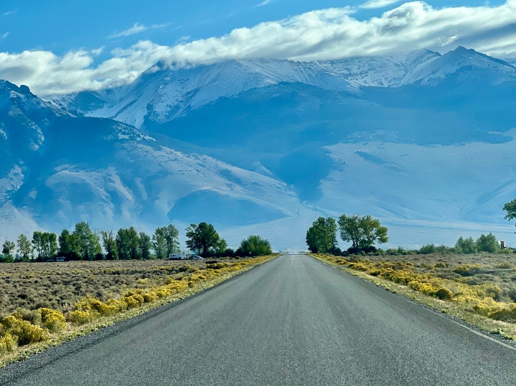
If you think this sounds like a dumb, disorganized travel story, wait for it. We actually have a nice Rand McNally Road Atlas (large print version) in the van specifically for situations just like yesterday. We brought it because signals are sparse out here and a GPS can give you really sketchy information. When we finally looked at it yesterday afternoon, Doug had neatly pre-highlighted the correct route. Why didn’t we look at it earlier? I do not have a plausible answer. However, the entire mishap was almost worth it for the view driving out this morning.
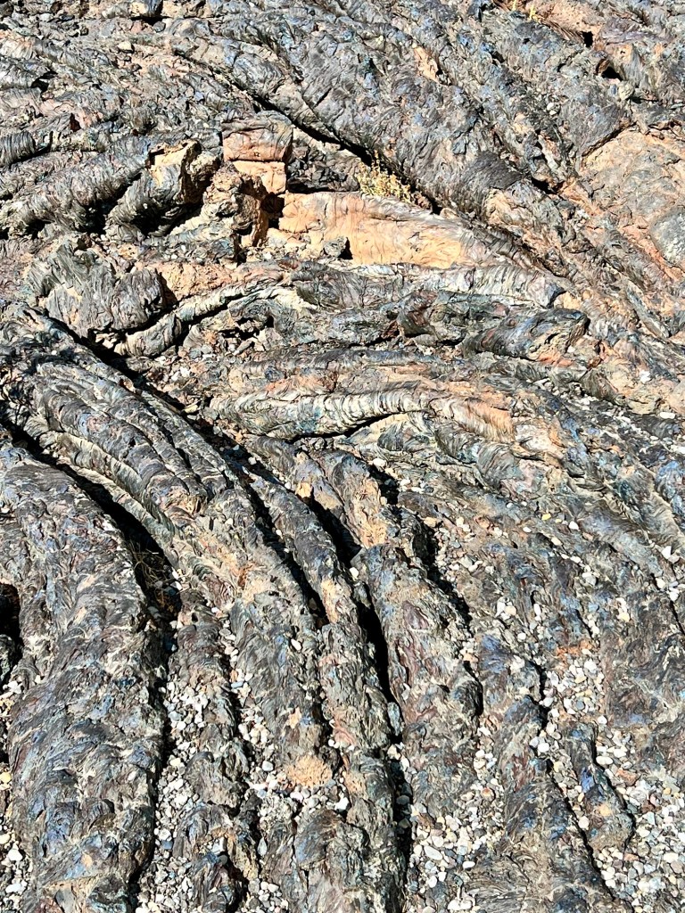
After leaving the wilds of the back of nowhere, we drove south to Craters of the Moon National Monument and Preserve near Arco, Idaho. The Monument and Preserve encompass three major lava fields which lie along the Great Rift of Idaho, a 62 mile long fissure zone that arcs across the eastern Snake River Plain. This is, of course, an extremely simplistic description of a major geological feature, but it was cool, so I took some pictures.
The Lava Fields
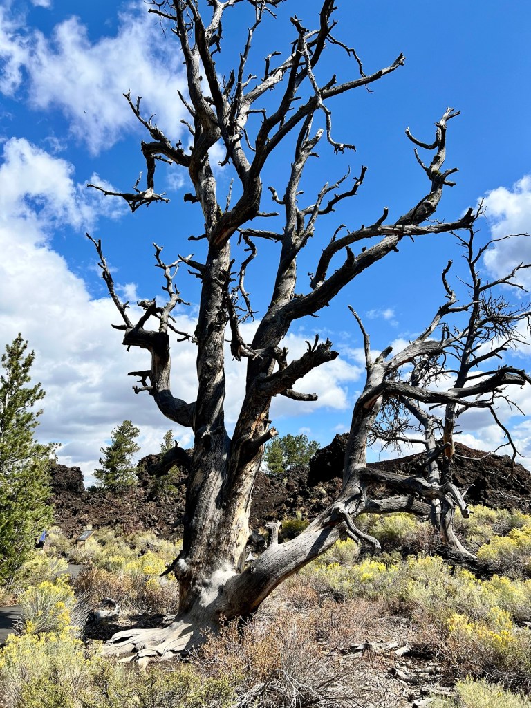
If you are wondering about the dead tree, there are many of them scattered across the landscape. Apparently in the 1960s, park managers cut and poisoned more than 6,000 trees at Craters of the Moon. The trees were not invasive species and they posed no threat to visitor safety, but The National Park Service justified this management as a way to protect forest health. These trees were resilient enough to grow in a lava field and then some idiots came along and killed them. Pretty sad.
I was wondering today why some places in the United States are designated as monuments, so I looked it up. The Antiquities Act of 1906 gives presidents the power to proclaim national monuments through executive action. President Theodore Roosevelt used the act to declare Devils Tower in Wyoming as the first U.S. national monument. President Calvin Coolidge established Craters of the Moon National Monument in 1924, preserving “a weird and scenic landscape, peculiar to itself.” There are 134 national monuments in the U.S. Some of the most famous of these are the Statue of Liberty, Mount Rushmore, the Liberty Bell and the Lincoln Memorial.
Tonight we are in Pocatello, Idaho, home of Idaho State University and also the United States Smile Capital. Apparently, there is some archaic ordinance in Pocatello that makes it illegal not to smile. Strange.
Note: A small correction for my September 12th blog: I called the ranch in “Yellowstone” both Sutton and Dutton. It’s Dutton. Apologies to all of you “Yellowstone” fans.
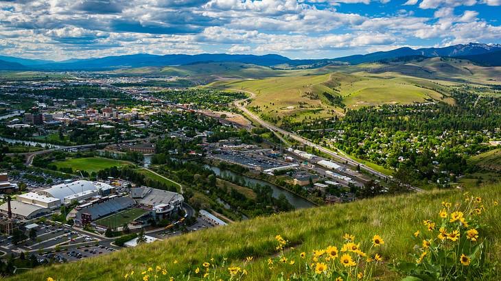
On Tuesday afternoon we flew from Atlanta to Missoula, Montana where we spent the night before going to retrieve Vanna the next morning. To give you an idea of the geography of the area around Missoula, when Meriwether Lewis visited in 1805 he called it the “hub of five valleys.” These valleys are located at the convergence of five mountain ranges—the Bitterroot Mountains, Sapphire Range, Garnet Range, Rattlesnake Mountains, and the Reservation Divide.
The picture above is of Missoula in a clear day, which was not the case yesterday. Over the summer there have been numerous wildfires in the areas surrounding Missoula, so when we arrived there was a heavy smoke and ash cover over the entire valley area. Vanna has spent the last two months in Jellystone RV & Boat Storage in Missoula, and although she was under roof, the sides of the storage were open and she was covered with with a nasty looking orangey ash. Very unsightly. Doug couldn’t wait to clean her up, but car washes big enough for RV’s are hit and miss. Thus we spent most of the morning looking for a car wash. Fun times. The picture below is what the area looks like now, but maybe not so dramatic.
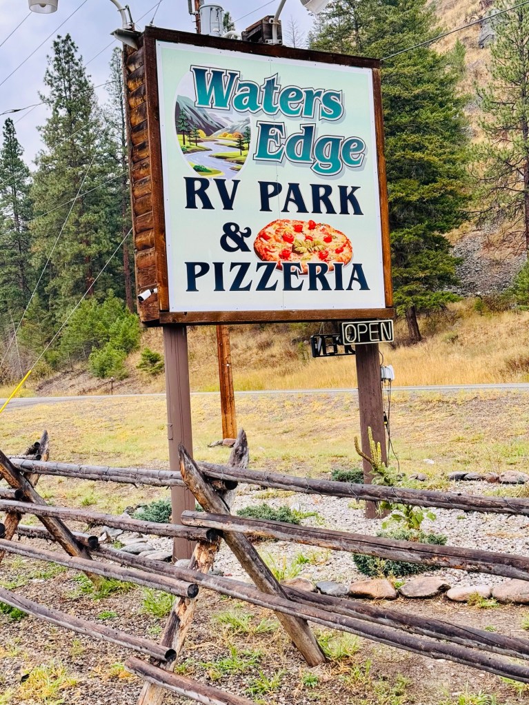
Last night we stayed at Waters Edge Campground and Pizzeria in Fork, Idaho. Well, we stayed in the campground, not at the pizza place. When we pulled up around 4 PM, the pizzeria looked forlorn and deserted. By 5:30, the lights were on and the parking lot was full. What the heck? We always like to try local eateries, so we decided to go over and give it a go. It was one of those old school places with Western Red Cedar tongue-in-groove on the walls, worn wood floor, and simple wood tables and chairs. The decor was largely taxidermy in the form of several mule deer mounts, along with numerous small framed pictures of hunters and their conquests.
Not only was the decor old school, the people who were there eating looked like movie extras in an old western. Almost every man in there had a long gray beard and was wearing a well-washed plaid flannel shirt and faded Lee jeans. The women did not have on prairie dresses, so it wasn’t quite perfect, but it was still uncanny. And surprisingly, the food was really good. Apparently, it was run by a family, and all of them were pressed into service. The son was the cook, Mom was the pastry chef and hostess, Dad was the bartender and general go-for, and the granddaughter was the bus girl and dishwasher. Since I was raised in a small family business I always feel nostalgic to see that some things have not changed.
On our way to Water’s Edge, we drove through Darby, Montana where “Yellowstone” was filmed. I have only seen “Yellowstone” once or twice, but I did recognize the little clothing store in the downtown area where the owner treated Kayce Dutton’s wife like crap because she was a full-blooded American Indian. (That scene confused me. Is that kind of prejudice still a thing in the American West?). Anyway, we drove right by the Chief Joseph Ranch (the Sutton Ranch in the series), which is a working cattle ranch and historic landmark in Montana’s Bitterroot Valley. The ranch’s main house is a 6,000-square-foot mansion built in 1914 that’s used as the Dutton family home in the show. (If you don’t watch the show, disregard this last paragraph.)
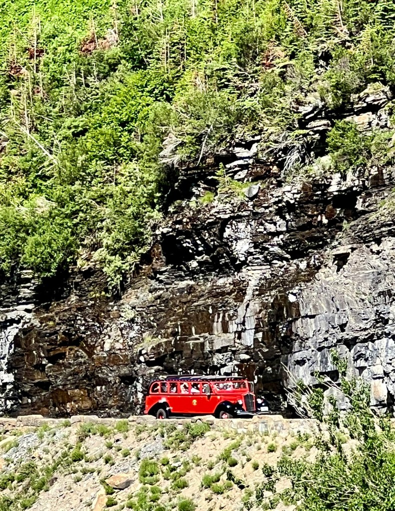
On Monday we drove from the Many Glacier Hotel on the east side of Glacier National Park to Lake McDonald Lodge on the west side of the park where we spent the night. Glacier Park is a lot more undeveloped and rugged than Yellowstone, so there is only one road that traverses the park, Going-to-the-Sun Road. A short road goes into Many Glacier, but all of the other roads are on the edge of the park. Since the park itself is roughly the size of Rhode Island, the interior is largely inaccessible. To use Going-to-the-Sun Road you must have a reservation, plus they don’t allow RV’s. Vanna is often ostracized in this manner. (I guess Vanna must be getting used to being ostracized by now.)
Lake McDonald Lodge was built in 1913 in the same Swiss Chalet style of the other two lodges we have visited. It’s fittingly located right next to Lake McDonald. However, this lodge was not built by the Great Northern Railway like the other two, but rather by a private developer named John Lewis. At the beginning of the Great Depression, Great Northern Railway took over the hotel and added several wings. The public areas at Lake McDonald are smaller than the other lodges, but are still quite stunning. Also, the rooms seemed more spacious and well appointed (at least our room), so that’s a plus.
I wondered why the railway built so many hotels in Glacier and apparently, the movement was part of a trend by railways during that time to build destination resorts in areas of exceptional scenic value. For instance, the Santa Fe Railway built El Tovar Lodge in the Grand Canyon. Also what I didn’t realize was that railways played a big part in establishing and promoting national parks in general, particularly Yellowstone, Glacier, Grand Canyon, Yosemite, Bryce, Zion and others. They wanted to entice people to travel out west, so they had a monetary interest, but it also helped the parks. There are even several books about the subject.
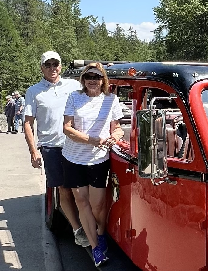
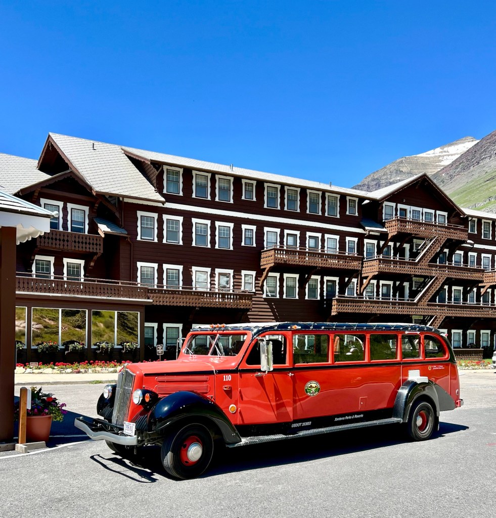
Yesterday before we left Glacier we took the Western Alpine Red Bus tour up to Logan Pass. I could totally see why Vanna couldn’t go up there because the road is narrow, winding and goes right up against a sheer rock face at times. We rode in a 1937 touring bus with John as our driver and tour guide. There are 35 of these buses that were built by the White Motor Company in the early 30’s especially for Glacier. They were originally owned by a private company, but by 2000 were in grave disrepair. In 2000, Ford Motor Company spent 6 million dollars refurbishing the touring buses—new motors, chassis, driveshafts, etc. They did it as a charitable contribution and the deal was that they had to be deeded to the National Park Service. So, now the NPS keeps them restored. They are really cool.
John, our tour guide/driver was a retired landscaper from central Illinois who decided to come here this summer and be a tour director. So far, it seems that there are basically three types of people who work in the parks: the large percentage are college students who are looking for a summer adventure out west; the second group are retirees like John who also want to try something fun for the summer; the third group are called “Parkies,” people who work in parks all year round, but are seasonal—for instance, they are at Glacier for the summer and the Grand Canyon in the winter.
I liked John. He had a headset for commentary, but instead of a non-stop serious commentary about the park, he had a lot of opinions. He couldn’t understand why the National Park Service didn’t replace the faded and bent-up sign at Logan’s Pass. Agreed. And he consistently talked to other drivers as in, “Hey, buddy, can’t you read the no parking sign?” Or, “Are you kidding me about pulling over there by that sheer wall?” My favorite was, “Wait, I’m going to blast my horn right at the moment we go by the guy parked by the sheer wall. That way it will really give him a start.” And he did blast his horn.
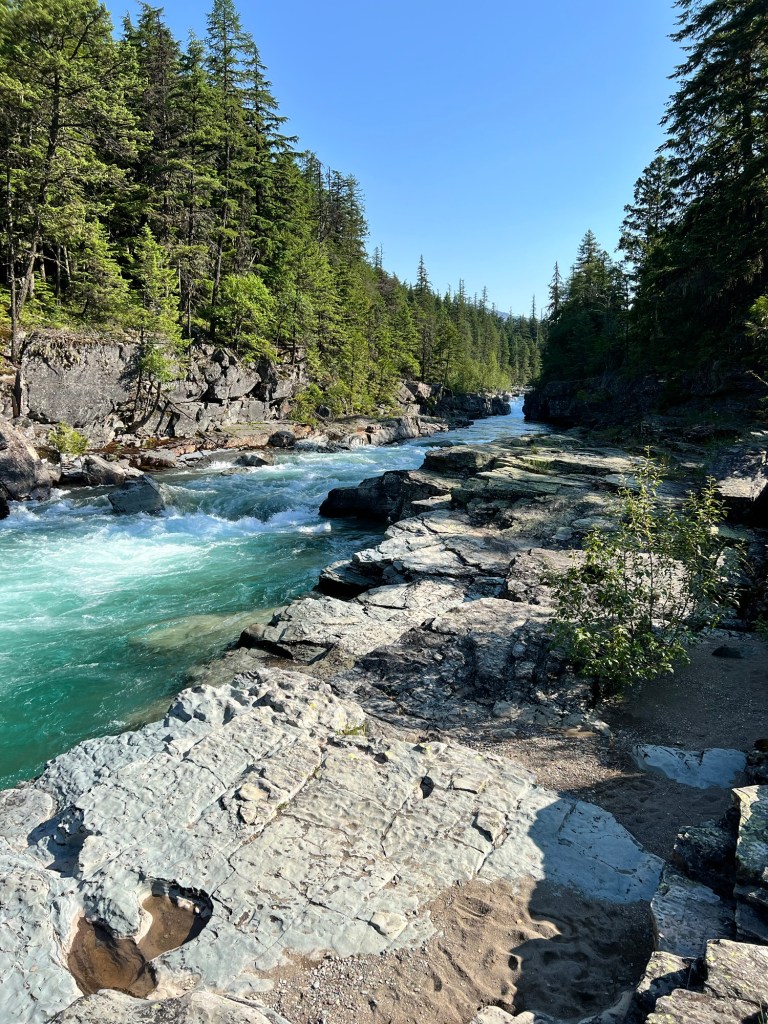
The streams and lakes in Glacier are the most startling color of aqua green to turquoise imaginable. The turquoise blue of the lakes in Glacier are caused by ground up bits of rock and sediment called “glacial flour.” The “flour” is produced by movement as the nearby glaciers erode the bedrock. The flour doesn’t sink or float, but rather remains suspended in the water, thus producing the bright color. Pictures do not really capture the color.
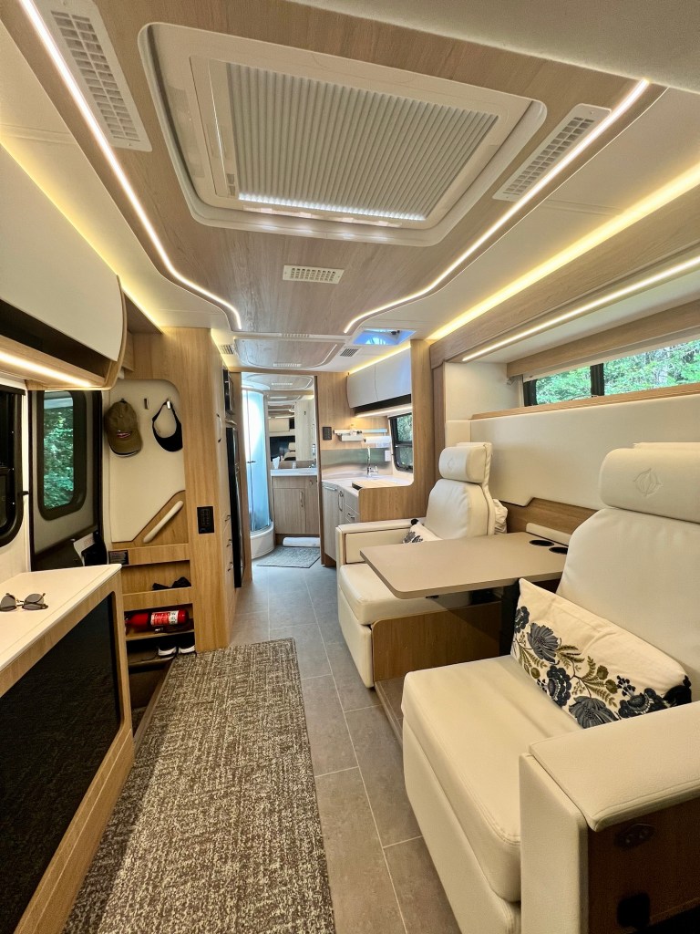
Last night we camped for one more night at Swan Lake. It was hot. We had maybe one or two cool days in Wyoming, but the rest of this trip has been hot. Not hot like humid Georgia, but a hot with no air-conditioning hot that finally gets okay by four AM when you have almost given up on getting any decent sleep for the night. For those of you who haven’t seen Vanna, this is a picture of the interior (it’s really not as spacious as it looks—it’s a wide angle shot). The two chairs are recliners, and they fold down and the table lowers for the Murphy bed that drops down from the wall behind them. The television on the left pops up out of the cabinet.
Tonight we are in Missoula, Montana. When we arrived the thermometer reading was 100 degrees. We left Vanna at Jellystone Park RV and Boat Storage where she will languish until mid September when we come back for the second part of our great western adventure. Tomorrow morning we fly out of Missoula to Atlanta. Nice trip, but it is high time we go home for a bit.
Last night we stayed in Glacier Lodge, a rustic lodge at the east entrance of Glacier National Park that was built in 1913 by the Great Northern Railroad. Huge Douglas fir timbers were brought to East Glacier by train from the Pacific Northwest to construct the lobby. There is a railroad station across the road that is part of the original railroad that has been going through East Glacier since the late 1800’s. They still have excursions on the passenger trains that are part of the Empire Builder itinerary, which goes from Washington state to Chicago.
Glacier Lodge
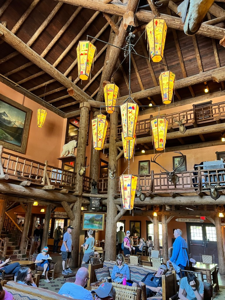
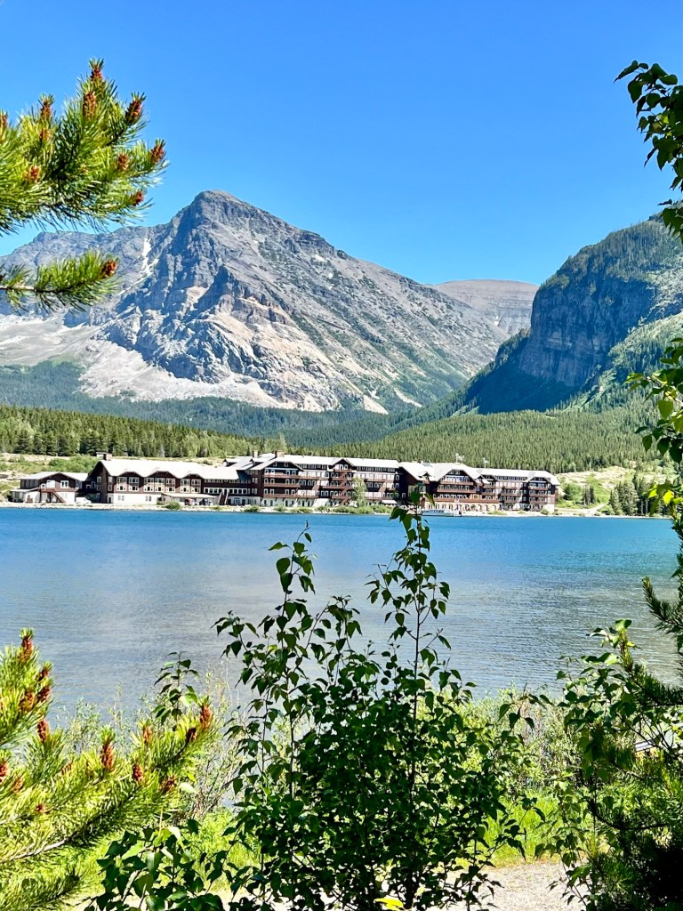
Tonight we are at the Many Glacier Hotel, which was built in 1914 on the shores of Swiftcurrent Lake. The hotel has a Swiss Alpine theme, which was part of an effort by Louis W. Hill, president of the Great Northern Railway, to establish Glacier National Park as a destination resort and to promote the area as the “American Alps” In fact, back in the early 1900’s Glacier was touted as America’s Switzerland, so all of the lodges in the park have the Alpine/Chalet theme. It could be a bit kitschy, but it’s built on such a grand scale that it works.
One thing to remember if you decide to stay in a national park lodge is although the lobbies are quite stunning, the rooms are quite basic and spartan. Very small rooms, minimal furniture, bare wood floors, and tiny bathrooms with showers even smaller than Vanna’s. The sheets are muslin and the towels are basic white terry cloth. There is no air-conditioning or television, and limited cell and Wi-Fi service. You have to be here for the charm and history, because these are not five star hotels. At times the sink is out in the room as below.
Our Room at Many Glacier Hotel
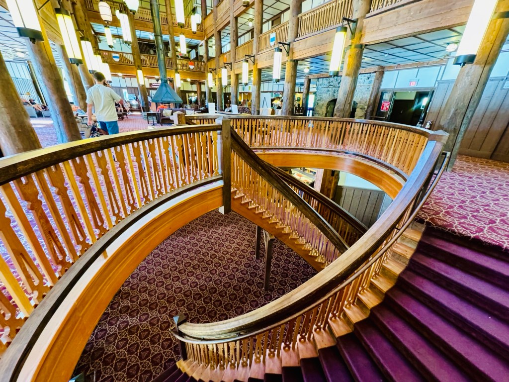
As I walk around these lodges built at the turn of the century I keep getting the feeling that I’m in the Overlook Hotel on the set of the movie, “The Shining.” Long wide hallways, cavernous rooms, heavy dark furniture, huge stone fireplaces, ornate carpets, curved staircases and giant iron light fixtures that burn dim lightbulbs. Sometimes I expect to see dead people in the empty lounges dressed in 20’s period costumes drinking and laughing. (If you haven’t seen the movie, disregard the last paragraph because it won’t make much sense.)
One thing we have noticed is how many huckleberry items are on the menus at all of the restaurants—huckleberry ice cream, huckleberry bread pudding, huckleberry martinis, huckleberry pancakes—the list goes on and on. Huckleberries are big in Montana and Wyoming because they grow on bushes at elevations above 5,000 feet. They are wild and cannot be commercially grown. If you don’t know what a huckleberry is, they look a lot like blueberries but are usually redder, smaller and a bit more tart. I looked up the saying “I’m your huckleberry” and it seems to have come from the American west in the 1880’s and means, “I’m your man,” or “I’m the one for the job.” It’s probably a lot more complicated than that, but that’s a rabbit hole I won’t go down right now.
There’s a 2.6 mile trail that goes around the lake that we walked today and the views are quite stunning. People kayak and canoe on the lake, plus there is a passenger excursion that cruises around the shore at regular intervals.
Irritation of the day: This afternoon some guy left his (could have been a woman, but I doubt it) car parked in the Porte Cache that is for check-ins only for a long time—far longer than it took to check in. The alarm system was apparently super touchy, so every time someone even got close to the the car, it honked for 30 seconds. This happened at least 10 times, thus breaking the serenity of a lazy sunny afternoon in one of the most gorgeous spots ever. What a putz. Or putzette if that fits.
Yesterday we decided that we may have extended our trip one day too long here in Whitefish. It’s a small town and we have pretty much seen all of it. We thought we would go see the city fireworks last night, but they were not until 10:30 PM, a bit late for us. The sun doesn’t set until about 9:45, so it wasn’t all that dark even at 10:30. Too late and too many people, so we were lame and watched them over the rooftops from our balcony. Pictures of fireworks are usually dull, but here’s one anyway. And also a picture of downtown and the city beach.
Every night at 10 PM a really loud siren goes off in Whitefish. It began in 1919 when the “Ding-Dong Ordinance,” (a curfew for children), was made law. When children 16 and under heard it, they had to rush home. Back in 2009, they discontinued the siren because OSHA said it was too loud for the firefighters and EMTs who were trying to rest between emergencies. However, in 2010 they built a new fancy city hall on the main drag, and the firefighters and EMTs were moved elsewhere. For some reason, probably tradition, the city council voted to bring back the curfew siren and it goes off every night at 10 PM again. Not sure what the function is, but it is extremely loud and startling.
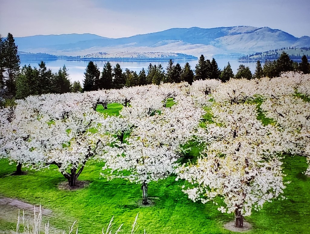
We drove around Flathead Lake yesterday just south of Kalispell for views of yet more mountains and more water. Absolutely stunning. Flathead is the largest natural freshwater lake (by surface area) in the United States west of the Mississippi. (Lake Tahoe has more water because it’s deeper.) Apparently, the east shore of the lake is known for its cherry orchards. People found that Flathead Valley was the perfect climate for growing sweet cherries, mostly Lamberts and Lapins, because of the long warm days with plenty of sunshine and night temperatures of 40-50 degrees. It’s kind of a microclimate. We didn’t buy any cherries because they won’t be ripe until the middle of July. Disclaimer: The following picture is from spring when the cherries were blooming, so I did not take it.
Cherry Trees Along Flathead Lake
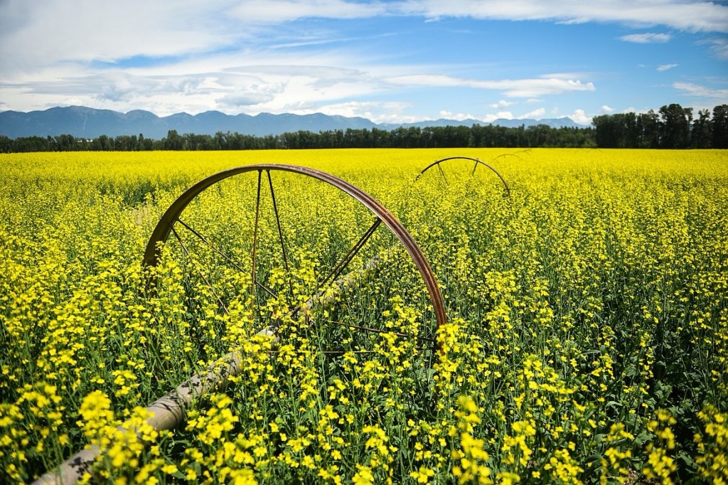
Another crop we have seen in Montana is canola. Canola is grown in huge fields and is the most vivid color of yellow ever. I was thrown by canola fields. I see canola oil in the grocery store and have always thought it was some kind of fake, healthy cooking oil. But it’s a natural oil, just more processed and less flavorful than olive oil. The reason it seems new is because the canola plant was developed in the 70’s by Canadian scientists. (Yes, I understand that was 54 years ago which isn’t really new, just new to me). The name canola comes from Canada, can, and oil, ola. The fields are pretty, but I think I will stick to olive oil.
Canola Field
Oh, and there is supposed to be a Flathead Lake Monster, but we didn’t catch site of it. There have been more than 115 reported sightings of the monster, as well as a few sketchy photos of something people claim is the monster. Eyewitnesses typically describe the beast as eel-shaped, from 20 to 40 feet in length, sometimes with four flippers. Of course it’s an urban myth, possibly handed down from the Salish Indians who once populated the area. I guess it is kind of the Loch Ness monster of the American West. I won’t post pictures I found because they look super fake to me.
Tomorrow we pick up Vanna, say goodbye to Whitefish, and head 35 miles northeast to Glacier National Park where we will spend a few days.